Automatic drawing
with point codes
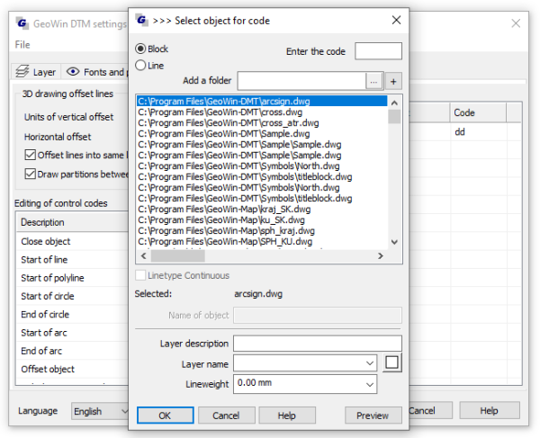
Code editor

3D
drawing offset lines
Units of
vertical offset, in what units will altitudes be entered,
implicit value 100 (in centimeters)
Horizontal
offset, how much it will indent in horizontal direction,
implicitly set to 0.02
Offset
lines into same layer, determines if indented lines wil be
drawn to the same surface as the original, or to surface determined
by GeoWin, implicitly 1 (to the same surface)
Draw
partitions between offset lines, determines if vertices of
indented line will be connected with the original one, implicit
value 0 (no drawing)
Function searches constituents contained in searching path of
CAD and displays them,
Automatic drawing with point codes
Automatic drawing according to the instructions of line of
points is installed in function „Loading points to drawing.“
Function can insert point signs, or draw line of points
(line segments, arches) according to the codes in the list of
coordinates.
Every point can contain codes for signs and also for line of
points and identificators of action.
Example of a file of coordinates with coding of
drawing:
| 3 |
741190.970 |
1033213.471 |
200.47 |
SI S OPN15 |
start of line type
SI, and also indents 14cm
in height
|
| 4 |
741169.820 |
1033213.405 |
199.58 |
SIA S |
|
|
5 |
741190.970 |
1033161.823 |
180.69 |
SI
ZO OPN14 |
start of an arch by
line type SI, and also indents 14cm in height
|
| 6 |
741169.371 |
1033160.650 |
170.71 |
SIA ZO |
|
| 7 |
741203.568 |
1033171.531 |
198.82 |
BZ CHB
S |
|
| 8 |
741206.300 |
1033147.980 |
198.93 |
SI OPN12 LA |
line type SI goes
through this point, and is indented 12cm in height and a lamp
defined by code LA
|
| 9 |
741183.502 |
1033137.767 |
197.04 |
SIA SIC
S |
line type SIA goes
through this point, and the line type SIC starts
|
| 10 |
741227.473 |
1033143.140 |
198.15 |
SI KO CHB |
arch ends at this
point with line type SI, and also sidewalk type line CHB goes
through this point
|
| 11 |
741212.927 |
1033128.612 |
198.26 |
SIA KO |
|
| 12 |
741258.161 |
1033171.531 |
198.37 |
BZ U CH S SIC |
line BZ closed, start
of line type CH, line type SIC goes
through this point |
| 13 |
741270.113 |
1033143.786 |
199.48 |
SI CH |
|
| 14 |
741267.762 |
1033129.552 |
200.59 |
SIA |
|
User point codes:
where there are codes SI, SIA there is the line of the road, code
BZ is a walled building, LA is a code for a sign of lamp, codes CH
and CHB are for sidewalk. Unknown codes will be asked about by the
function and it will replenish them to registers. Codes can be
written in the lines of BZ.1 BZ.2 etc. Function will take over
settings from original code.
Sample data file with coordinates is placed in the file
GeoWin DTM.
Control codes ( identifiers of action ):
S, starting of drawing of
new line of points must be introduced by code of line, e.g.:
SI S, where SI is a code for road line, if not listed as another
identificator ZO, line segment is drawn, if listed, drawing of arch
begins, Function searches for and then connects all points with
code (in this case) SI, until the end of file or a line with a
start of the same lineidentificator (SI S).
SK, starting point of curve
(polyline2D/3D, according to settings), then everything same as in
identificator S
U, to close, draws line
segment/curve z bodu u kterého je tento identifikátor, k
nejbližšímu pøedchozímu bodu s identifikátorem akce S nebo SK
(oba musí mít samozøejmì stejný kód linie)
ZO, starting point of the
arch,drawing of arch begins with this point, this identificator can
be set along with identificator S
O, drawing of the arch is
complete
ZK, starting point of circle,
circle is not involved in preceding or following actions which
means: if circle has the same code of line as the preceding one,
then a line of points is not drawn from the preceding point to the
point with code of the circle, it is the same as if the point would
have an identificator of action S.
KK, ending of circle, if a point is defined in instructions
between ZK and KK, function creates circle so it would go through
these three points, if there are only ZK and KK in instructions,
function creates circle sopoint with code ZK iscenter of circle and
radius is defined by point with code KK, if continuing line of same
code as the circle it is necessary to assign identificator of
action S
TX, inserts text defined by user
into the drawing, after this identificator, e.g. TXHello (no
space!), inserts text „Hello“ to the drawing.
OPN,OPD,OLN,OLD, are
identificators for position and height indentation of line/curve.
After this identificator value of height change must follow, e.g.
OPN15 marks offset on the right side and 15cm up in height, OLD15
would mark offset on the left and 15cm down in height. Position
indentation is read from current template (Section Setting
enviroment, item Indentation of coordinates). Units for height
indentation are preset to cm (section Setting enviroment, item of unit
Indentation). If height indentation is defined by value 0,
then the horizontal indentation also equals to 0 in this point. As
soon as height indentation is defined, it is valid until next
change or until code with 0 value.
DO, replenishes the last 3linked
points to a rectangle (line, curve).
Notes:
Arches can be drawn by two points(is then drawn as tangent to the line
drawn last), or by an
arbitrary number of points-
the first three points are drawn as an arch and others astangential
to previous arch. It is suitable for the identificators to be close
to each other during actions for lines and code for point signs to
be in the beginning or in the end. E.g.: BZ S OPD14 SI OPN12
LA, in this point there
will be two lines with indentation and a point sign will be placed.
Another possibility how to write this code is LA BZ S OPD14 SI
OPN12, or BZ S OPD14 LA SI OPN12. BZ S LA OPN15 is not
possible, identificator of
indentation is no longer assigned to BZ line, but to lamp!
Limits:
Length of all codes per line is limited to 50 characters (including
spaces) and 20 codes maximum (except from identificators of action
- those are automatically assigned to the code by function)
Two arches cannot be assigned to one line
just next to each other, there has to be at least one line segment
in between them, practically meaning that identificators ZO KO
cannot follow after code of line. E.g. SI ZO KO, where SI is code of line, is
unacceptable, but SI ZO BZ KO is possible; where BZ is code of
walled building.
|

