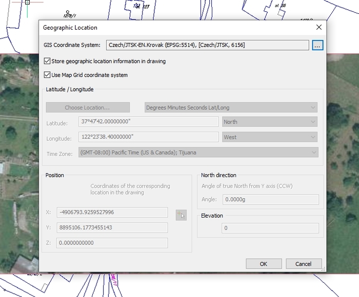
En el primer paso, elegimos el sistema de coordenadas (comando _GEOGRAPHICLOCATION)
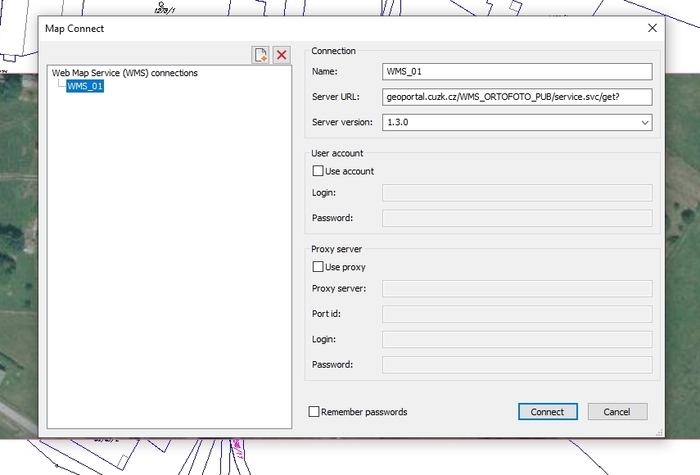
In the second step we set the WMS address ( command _MAPCONNECT )
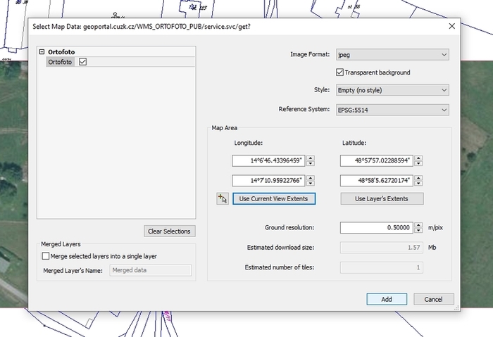
After Connect another dialog will be displayed.
Last step. We set the plotting area and the resolution (meters/pixel).