Software for processing digital model of terrain. It is meant for surveyors and project architects.
Main attributes:
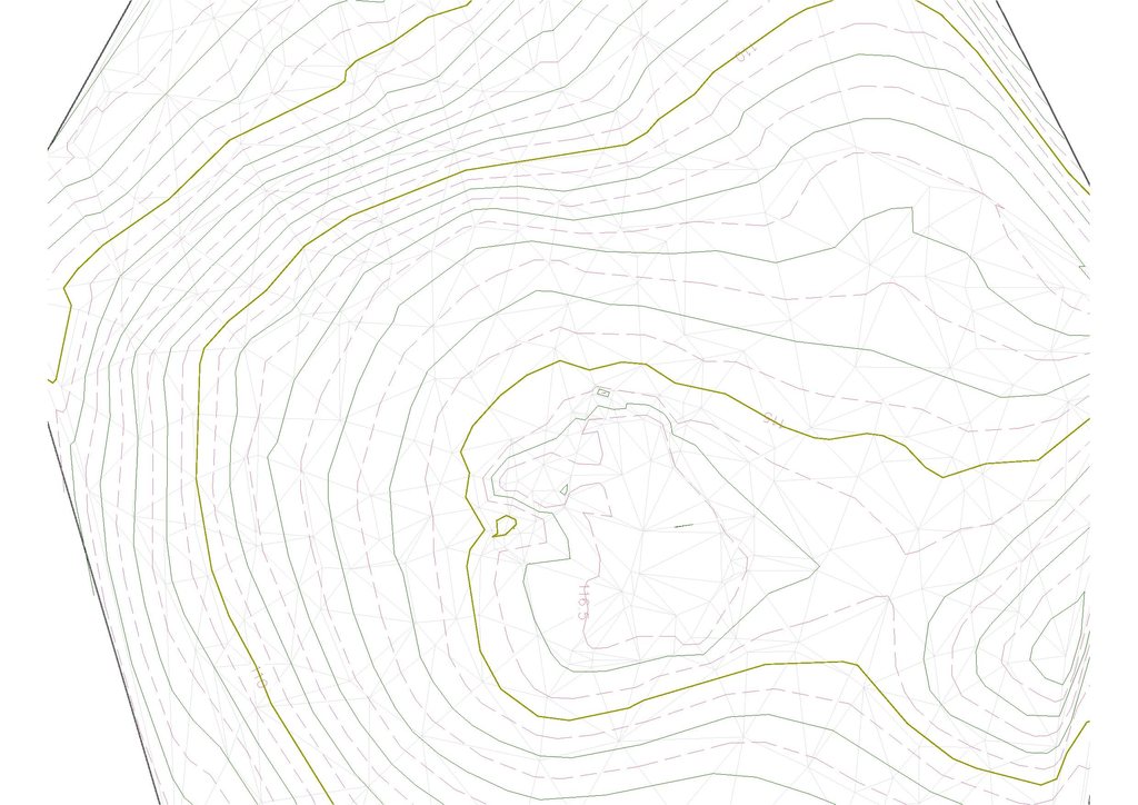
- triangular mesh (TIN) with obligatory edges
- contours
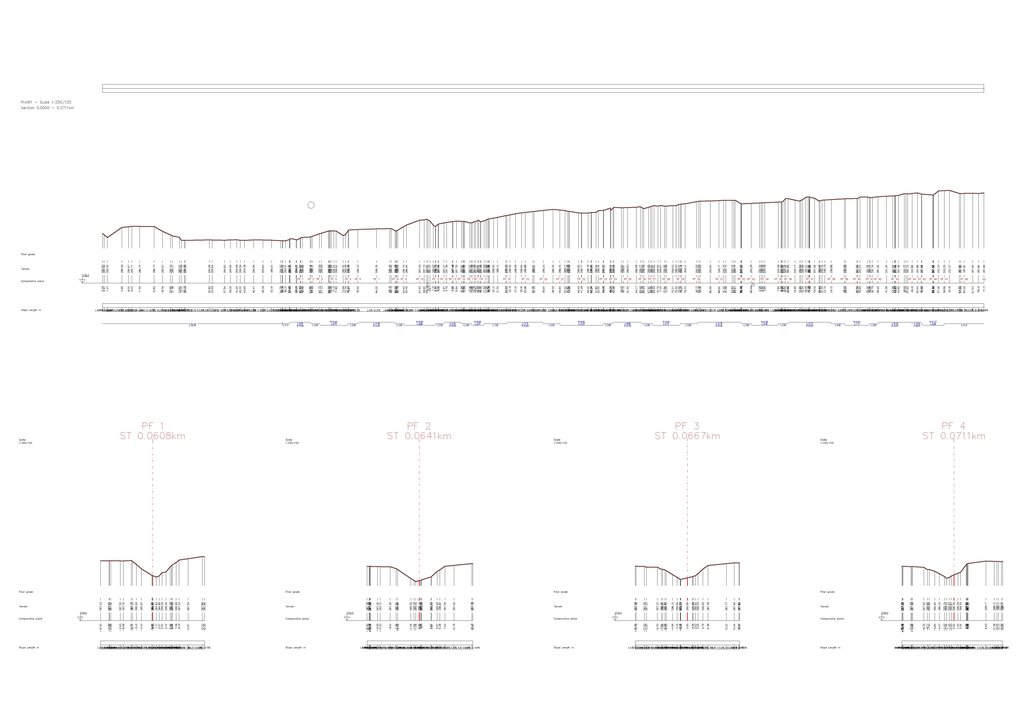
- longitudinal profiles and cross sections
- calculating volume of TIN
- STL import and export
- dynamic editing of TIN
- editing of curves
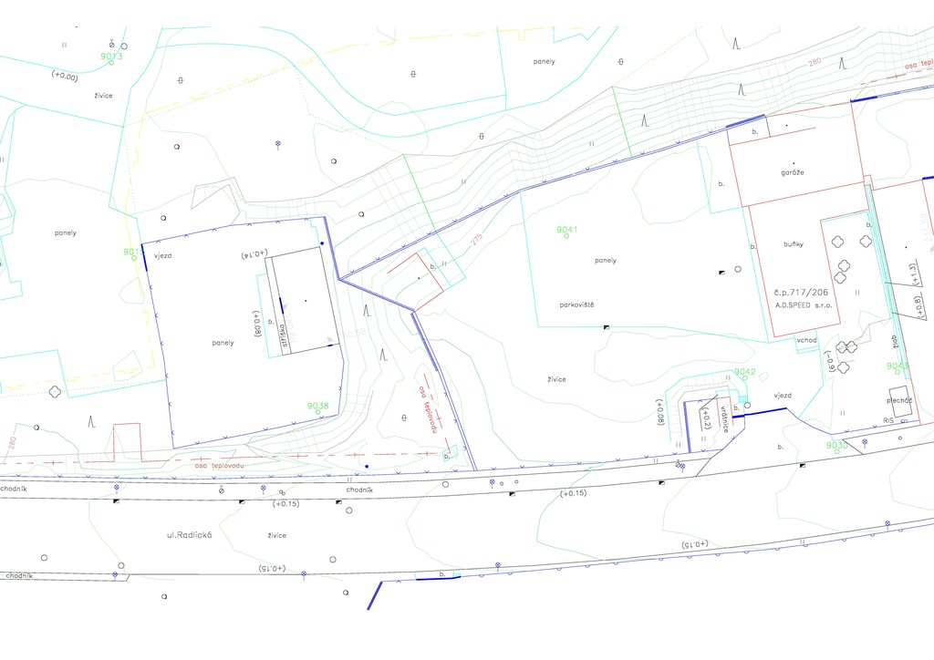
- import and export of point coordinates
- automatic drawing with point codes
- import and export LandXML
- WMS
- export to KML/KMZ file (Google Earth)